📋 Summary
- The Tokyo Bay Aqua-Line, officially opened in December 1997 after nine years of construction, connects Kawasaki and Kisarazu across Tokyo Bay via a combination of a 4.4-kilometer bridge and a 9.6-kilometer undersea tunnel, one of the longest underwater tunnels in the world
- Umihotaru, meaning “sea firefly,” is an artificial island marking the transition between the bridge and tunnel sections, functioning as a genuinely unique mid-ocean rest stop with restaurants, shops, and observation facilities
- Standard tolls for private vehicles are commonly cited around 3,000 yen, though electronic toll collection can reduce this to roughly 800 yen in many cases, making the crossing considerably more affordable for regular ETC-equipped drivers
- The route dramatically shortens travel time between the Tokyo/Kawasaki area and the Boso Peninsula in Chiba, transforming a trip that once required a lengthy drive around the bay into a direct crossing
Few drives in the greater Tokyo area offer an experience quite as genuinely unusual as crossing Tokyo Bay itself via the Aqua-Line, a route that takes drivers from an elevated bridge directly into an extended undersea tunnel, with a stop on an artificial island in between. Understanding this route’s engineering, history, and practical logistics makes for a genuinely rewarding addition to any driving-focused visit to the greater Tokyo region.
- A Bridge-Tunnel Combination Connecting Two Prefectures
- Umihotaru: A Rest Stop Unlike Any Other
- Why This Route Matters Practically, Not Just Scenically
- Combining the Aqua-Line Into a Broader Chiba Driving Itinerary
- The Engineering Challenge Behind a Bridge-Tunnel Hybrid
- What to Expect When Visiting Umihotaru
- Frequently Asked Questions
A Bridge-Tunnel Combination Connecting Two Prefectures
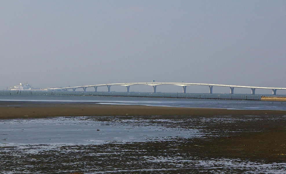
The Tokyo Bay Aqua-Line, also known as the Trans-Tokyo Bay Expressway, connects Kawasaki in Kanagawa Prefecture on the western side of Tokyo Bay with Kisarazu in Chiba Prefecture on the eastern side, spanning a total length of 23.7 kilometers. The route combines two genuinely distinct engineering approaches: a 4.4-kilometer bridge section and a 9.6-kilometer tunnel running beneath the bay itself, commonly cited among the longest underwater tunnels in the world. This combination approach reflects a deliberate engineering compromise, using a bridge where surface-level construction was practical while tunneling beneath the bay’s active shipping lanes where a bridge would have created genuine navigation hazards for the substantial vessel traffic using Tokyo Bay.
The Aqua-Line officially opened to traffic on December 18, 1997, following a genuinely long development timeline: construction itself began in 1989, following roughly two decades of preliminary investigation and planning, and required nine years of construction to complete, reflecting the substantial engineering challenge of building both a major bridge structure and an extended undersea tunnel as a single connected route.
Umihotaru: A Rest Stop Unlike Any Other
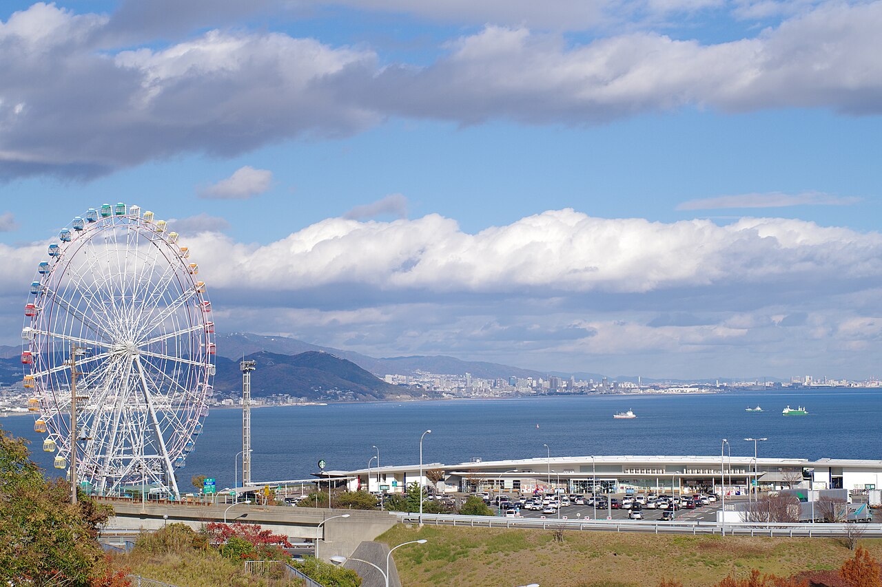
At the precise point where the bridge section transitions into the tunnel, drivers encounter Umihotaru, meaning “sea firefly” in Japanese, an artificial island constructed specifically to serve as both a structural transition point and a genuinely unique rest stop facility. Umihotaru offers restaurants, shops, and observation areas, giving drivers the distinctly unusual experience of stopping for a meal or a scenic view from an artificial island positioned in the middle of Tokyo Bay itself, with genuinely striking views back toward central Tokyo’s skyline on clear days.
💡 Tip: ETC Meaningfully Reduces the Crossing Cost
Standard tolls for private vehicles crossing the Aqua-Line are commonly cited around 3,000 yen, but drivers using Japan’s electronic toll collection system, commonly known as ETC, can see this cost reduced to roughly 800 yen in many cases, a genuinely significant discount. For international visitors driving a rental car in Japan specifically planning to cross the Aqua-Line, confirming whether your specific rental vehicle is ETC-equipped, and whether you have an appropriate ETC card, before your trip can meaningfully reduce your total travel cost, making this detail worth checking directly with your rental provider rather than assuming standard cash toll pricing applies.
Why This Route Matters Practically, Not Just Scenically
Beyond its genuine novelty as a driving experience, the Aqua-Line serves a real practical transportation function, dramatically shortening the trip between the greater Tokyo and Kawasaki area and the Boso Peninsula region of Chiba Prefecture. Before the Aqua-Line’s construction, traveling between these two areas required driving entirely around the bay, a considerably longer journey. The direct crossing has meaningfully reshaped travel patterns and even regional development around both endpoints, making destinations on the Boso Peninsula, including its beaches and rural driving routes, genuinely more accessible as a day trip from central Tokyo than they would otherwise be.
⚠️ Caution: Tunnel Driving Requires Its Own Attention and Preparation
Driving through an extended undersea tunnel section like the Aqua-Line’s roughly 9.6-kilometer tunnel differs meaningfully from typical surface road driving, and deserves its own attention regardless of how experienced a driver you are. Maintain safe following distances, since tunnel lighting and enclosed acoustics can make speed and distance judgment feel different than on an open road, and be aware that mobile phone signal and GPS navigation can sometimes be less reliable within extended tunnel sections, meaning it’s worth having your route and any exit plans clearly understood before entering the tunnel rather than relying entirely on real-time navigation throughout the crossing.
Combining the Aqua-Line Into a Broader Chiba Driving Itinerary
For visitors with time to explore beyond the crossing itself, the Aqua-Line functions well as a gateway into Chiba Prefecture’s own driving-worthy destinations on the Boso Peninsula, including coastal routes and rural roads considerably less crowded than central Tokyo traffic. Planning a visit that treats the Aqua-Line crossing as the opening leg of a broader Chiba exploration, rather than simply a there-and-back novelty drive, makes for a genuinely more rewarding use of the route’s practical time-saving benefit, particularly for visitors who might otherwise not consider the Boso Peninsula region worth the previously much longer drive around the bay.
The Engineering Challenge Behind a Bridge-Tunnel Hybrid
Understanding why the Aqua-Line uses a bridge for part of its route and a tunnel for the rest, rather than a single consistent structure type across the entire crossing, reveals genuinely interesting engineering reasoning. Tokyo Bay carries substantial commercial shipping traffic, and a bridge spanning the bay’s active shipping channels would have created serious navigation hazards and height restrictions for large vessels using the bay. By tunneling beneath the portion of the bay with heaviest shipping traffic while using more straightforward and economical bridge construction where surface conditions allowed, engineers found a practical compromise between construction cost, maritime safety, and overall project feasibility.
This bridge-tunnel hybrid approach, while not entirely unique globally, remains a genuinely impressive example of large-scale infrastructure engineering, and the transition point at Umihotaru offers curious visitors a rare opportunity to physically stand at the exact junction between two such different construction approaches, an experience most infrastructure crossings elsewhere don’t offer in nearly as accessible or visitable a form.
What to Expect When Visiting Umihotaru
Beyond its structural role, Umihotaru functions as a genuine destination in its own right for many visitors, not simply an incidental stopping point along the crossing. The facility includes multiple dining options, gift and souvenir shops specific to the unique mid-bay location, and observation decks offering views in multiple directions, toward central Tokyo’s skyline on one side and toward the Boso Peninsula and open bay on the other. Because of its genuine novelty as an artificial island rest stop accessible only by vehicle via the expressway itself, Umihotaru has become a destination some visitors specifically plan trips around, rather than simply passing through en route to somewhere else, particularly for photography enthusiasts drawn to its distinctive setting and skyline views.
Parking and facility capacity at Umihotaru can become genuinely constrained during peak visitation periods, particularly weekends and Japanese holiday periods, making arrival timing worth considering if a relaxed, uncrowded visit to the facility itself is a specific priority for your trip rather than simply crossing the bay as efficiently as possible.
Frequently Asked Questions
Q: When did the Tokyo Bay Aqua-Line open?
A: It officially opened to traffic on December 18, 1997, after construction that began in 1989 and took nine years to complete.
Q: How long is the Aqua-Line, and what does it consist of?
A: The full route spans 23.7 kilometers, combining a 4.4-kilometer bridge section and a 9.6-kilometer undersea tunnel, one of the longest underwater tunnels in the world.
Q: What is Umihotaru?
A: An artificial island marking the transition between the Aqua-Line’s bridge and tunnel sections, functioning as a rest stop with restaurants, shops, and observation areas offering views of Tokyo Bay and the Tokyo skyline.
Q: How much does it cost to cross the Aqua-Line?
A: Standard tolls for private vehicles are commonly cited around 3,000 yen, though ETC electronic toll collection can reduce this to roughly 800 yen in many cases.
Q: What should I be aware of when driving through the tunnel section?
A: Maintain safe following distances since tunnel conditions can affect speed and distance judgment, and be aware that phone signal and GPS reliability can be reduced within the extended underwater tunnel section.
This article is for general informational purposes and reflects commonly cited information about the Tokyo Bay Aqua-Line. Specific tolls and facility details change over time – always verify current information with official sources before planning a visit.
コメント